The section above was captured from the window of the "Flying Fiesta" ST-Line (3 cylinder 1.0 litre turbo with a 48 Kw boost motor). Gareth took a real shine to this car and was quite keen to demonstrate its nippy credentials, making for some interesting - scratch that - creative, motion blur.
But these stones paled into insignificance compared to the ancient ones dotted around the area.
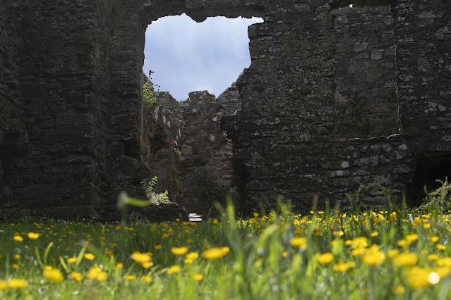
First up, the ruin of Dundrum Castle, a short drive along the coast and free to enter. On our two visits here, we didn't see another soul.
The castle was believed to have been built in or around 1177 by Anglo-Norman knight, John de Courcy, as part of his coastal defence after his invasion of Ulster.
De Courcy's exact parentage is unknown. The man thought to be his great grandfather, Richard de Courcy, is named in the Domesday Book. De Courcy's grandfather, William de Courcy I, married Emma de Falaise. His father, William de Courcy II married Avice de Rumilly an died before 1130, leaving the family estates in Somerset and elsewhere in England to his son, William de Courcy III, John's possible brother.
John was very ambitious and wanted lands for himself. He decided to invade the north of Ireland which was controlled by Irish dynasties. In early January 1177, he assembled a small army of 22 knights and 300 foot soldiers and marched north, at the rate of 30 miles a day. They skirted the back of the Mourne Mountains and took the town of Downpatrick by surprise. After two fierce battles, in February and June 1177, de Courcy defeated the last King of Ulaid (Ulster).
De Courcy's original castle may have had defences of earth and timber, but the stone curtain wall of the upper ward was probably built at the beginning of the 13th century.
The gabled L shape manor house in the south west corner of the outer bailey, was built by the family of Sir Francis Blundell, circa 1660.
The views out towards the mountains and over Dundrum Bay clearly made it an attractive proposition for a fortress.
Dundrum Castle is an amazing place with no litter or drunken teens to be seen on our visits. We returned on our last night to soak up the atmosphere in the dying light. Oh and to prove that I wasn't dressed like a bag lady for our entire stay (I'd prioritised warmth over style), here's a grainy mobile pic taken by Gareth.
If you've ever travelled around Ireland (more so in the Republic), you will be aware that the signage is "playful." By "playful" I mean that typically there will be a sign indicating that a certain town is, say, 5 km away. After following said signage and driving for a long 15 minutes, it's not unusual to spot another sign suggesting that the same town is now 8 km away.
On our mystery road trip to Ballynoe Stone Circle, the road signs welcomed us to the village of Ballynoe, but then left us hanging. Er, the stone circle? Anyone? In our frustration, we wound down the window to some school children spilling out of school and asked if they could direct us to the circle. One boy did so without hesitation, gesturing down the road, but there was literally nowhere to park. We were forced to tuck our car out of the way in a roadside pull-in in front of a farm gate and instinctively headed for this green gate.
Beyond the gate, was an enchanting tree covered and well trodden old sunken lane.
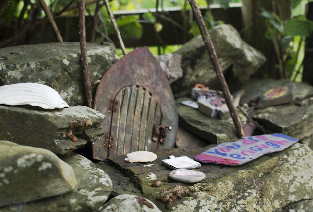
Maybe derivative of Irish folklore, visitors appear to attribute some kind of fairy kingdom energy to the area. Many of the trees lining the approach are adorned with trinkets and fairy offerings.
Within a few magical moments, we emerged in a field - totally alone - and took in the view of this late Neolithic/early Bronze Age stone circle.
The mound was most likely added in a later building phase. Three pairs of stones are positioned outside the circle and four stones on the western edge of the circle form an entrance, 2.1 m, wide to the circle. The entrance is perfectly lined up with the setting sun, on March 21st each year, which is the half way point between midwinter and midsummer.
Despite the cool breeze and unseasonably low temperature we experienced that day, the stones were not as cold to the touch as I expected. Without getting all hippy dippy about it, I really did experience some kind of energy.
The bush at the edge of the circle was also decorated with offerings; messages, ribbons and a collection of money at its base.
Ireland's not affectionately referred to as "craggy" for nothing. Another day, another stony silence, as, alone again, we located and entered a subterranean 9th century shelter - Finnis Souterrain - known locally as Binder's Cove. The site is a scheduled monument, being one of only a few souterrains open to the public.
 |
| Not for the claustrophobic |
The stony silence came when we entered - on our haunches - and despite the warning, Gareth managed to nearly knock himself out on the low lintel before the spotlights within illuminated our path. There was a sharp intake of breath; Gareth due to the impact, and me, anticipating a trip to A&E. Mercifully, his cap absorbed some of the impact and after he regained his footing, we continued.
The purpose of this souterrain has been debated over time, but the consensus is that it was built to provide shelter from invading Vikings and also used as storage for religious artefacts and possibly food.
Despite approximately 30 thigh-busting steps in a hunched over squat position, the cavernous space soon opened up into numerous chambers off the main walkway. In places, it was almost possible to stand up.
For the briefest of moments, I felt a little bit like Lara Croft, but even though I'm not particularly claustrophobic, the realisation that we had no phone signal and the thought of inadvertently triggering some kind of booby trap, causing a large stone boulder to roll in front of the narrow entry point, made me begin to retrace my steps. Outside, blinking like moles in daylight, we bumped into a young couple who had seen us arrive and approached us for a chat. They asked us where we were from and admitted to having fallen foul of that stone lintel more than once, when using it as a drinking den in their teenage years.
Our final monument; this time a megalithic monster, was Legananny Dolmen. This one was really off the beaten path and denoted by this farm gate. The only available parking was a layby with room for no more than a couple of cars.
And here it is in all of its glory, nestled between a farmer's stone wall and a back lane....5,000 years old if a day! This tripod dolmen has a capstone over 3m long and 1.8m from the ground. Such portal tombs were funerary sites for the disposal of the dead in Neolithic society. The stones would have been dragged some distance before being set in place. Some urns were discovered underneath the three supporting stones. Isn't it amazing?
On our return to the cottage, I did pause to ask the bull in our field his thoughts on all of this ancient history on his doorstep. (Incidentally, there were also the remains of a cashel (stone fort) at the top of the hill behind our holiday cottage, kindly pointed out by Sean on our first night). Bully Boy just snorted at me and strongly advised Gareth not to look at his missus.
Contrary to the opinion you might be forming, our trip to Ireland wasn't all about standing stones and quaffing Guinness. We did venture into the two capital cities, Belfast and Dublin, but I'll save that for the final chapter.


beautiful!
ReplyDeletelove your conversation with the bull :-D and that the cows in ireland can live on a meadow instead of a large concrete building.....
the ruins - fab views indeed! - and the ancient shelter, stone circle and dolmen are spectacular!! and the heavy skies adding to the mystic feel of your photos..... love your folky outfit - but poor gareth! (the BW is tall too and hit a many of our stony landscape over the years - thankfully he´s always wearing a cap ;-D)
how cool that all the monuments were not crowded!
xxxxx
Thank you!
DeleteThe cows seemed very content. Sean wasn't interested in intensive farming.
Gareth is particularly accident prone. I wasn't at all surprised when he hit his head! It might sound selfish, but it was really refreshing to be somewhere special without queues of tourists. xxx
It's amazing, those tranquil ruins, the stone wallsa nd the incredible stone circle You never see any mention of that on the tourist ads, do you> It's all about Guinness and the Craic!
ReplyDeletePoor Gareth, thank goodness he had a hat on!
You look gorgeous in your Indian block prints. xxx
No, they definitely keep some things under wraps!
DeleteGareth is the most accident prone person I know!
Thanks! I didn't just wear the jumper. :-D xxx
The playful signage and lack of tourist signs can only have added to the ambience of these ancient sites! And surely that tree covered sunken lane with its fairy offerings couldn't have been a more magical approach to the stone circle.
ReplyDeleteAs fascinating as it sounds, as I'm slightly claustrophobic I might have had to give Finnis Souterrain a miss, though. Ouch, poor Gareth! I'm glad a trip to A&E wasn't added to the stresses of your journey ... xxx
It's always good fun navigating around Ireland!
DeleteI spent just as much time in the sunken lane as I did around the stones. Such a special place!
I must admit, I wasn't sure I would make it inside Finnis Souterrain, but when the light came on and I realised the ceiling did get a bit higher, I was OK. xxx
Standing stones are such an interesting connection with the past, I enjoyed your post, thanks for sharing. Betty
ReplyDeleteYou're welcome Betty. Glad you enjoyed it.
DeleteOh, I am in heaven! Claire, this is just amazing! When my husband (then boyfriend) and I went to Scotland in 1996, we found a stone circle off in a field and went inside it (you crawled through a tunnel and came out in the centre with sky above) and it definitely had some energy!
ReplyDeleteAbsolutely! That sounds fascinating!
DeleteThis comment has been removed by a blog administrator.
ReplyDelete